Maps
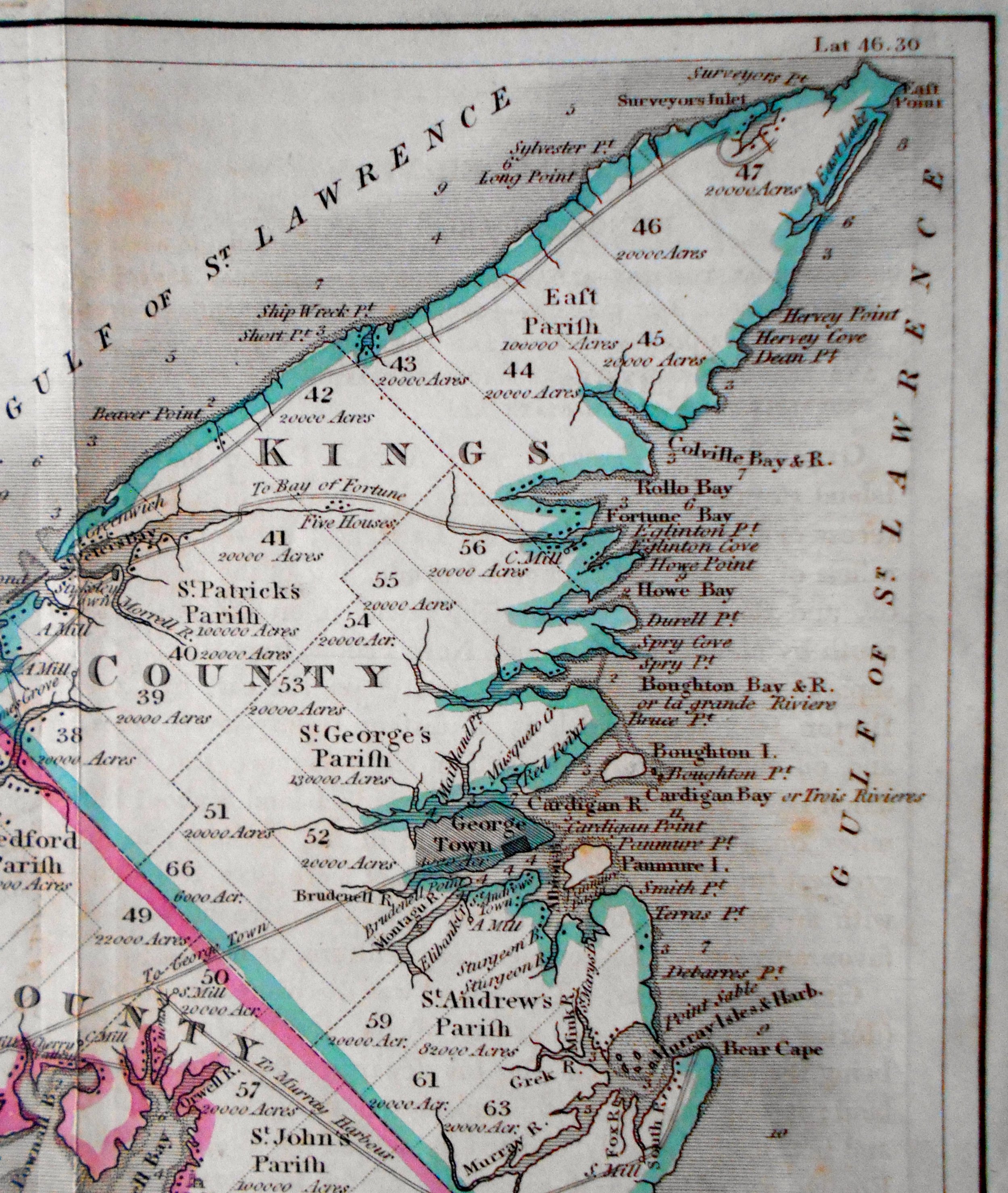
PEI Map (1834)


PEI Map (1834)
Title: Prince Edward Island, divided into Counties & Parishes, with the Lots as granted by Government, Exhibiting all the New Settlements, Roads, Mills, &c, &c.
Mapmaker: Cochrane & Co., Waterloo Place, (London): October 30th, 1834
Size: Approximately 7 1/4 x 14 3/4"
Description: Liberated from Montgomery Martin's History of the British Colonies, Vol. iii, Possessions in North America. Includes inset of the Gulf of St. Lawrence. Early hand-coloring in the outline. Shows 3 vertical folds from when it was folded into the Martin's book. Minor off-setting.
Robert Montgomery Martin (c. 1801–1868), commonly referred to as "Montgomery Martin", was an Anglo-Irish author and civil servant. He served as Colonial Treasurer of Hong Kong from 1844 to 1845. He was a founding member of the Statistical Society of London (1834), the Colonial Society (1837), and the East India Association (1867).
Source: Wikipedia