Maps
Prince Edward Island (1775)


Prince Edward Island (1775)
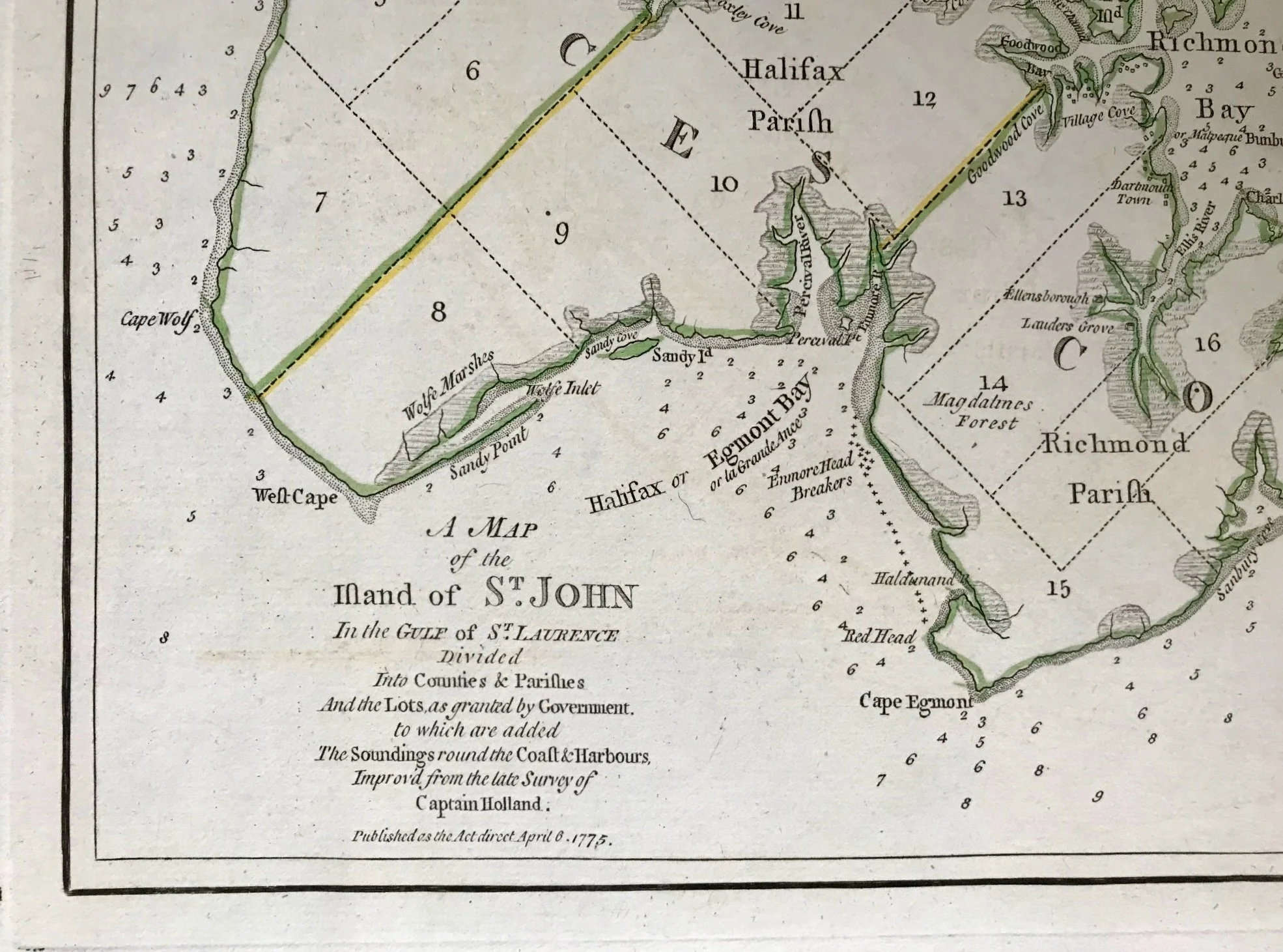
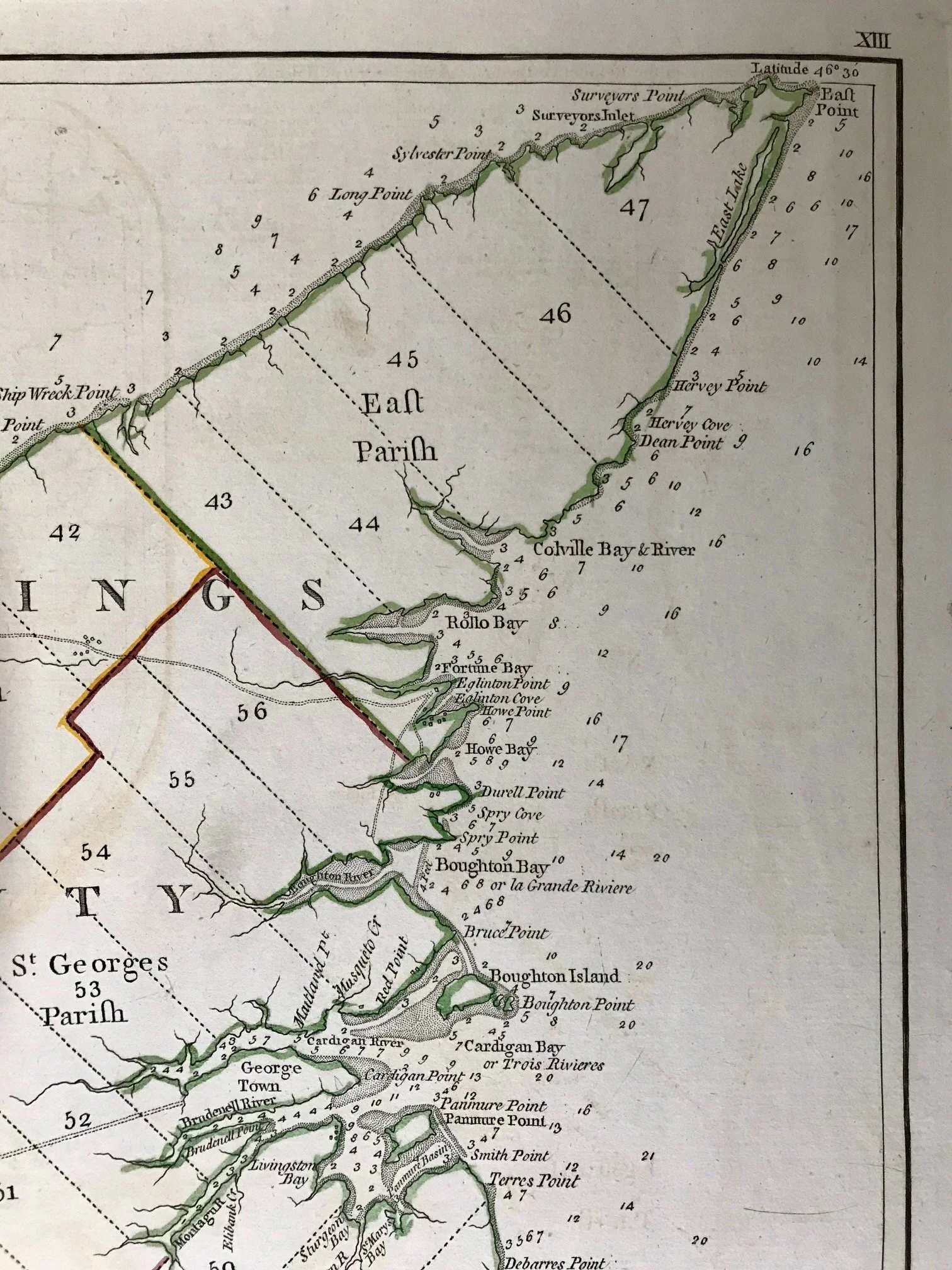
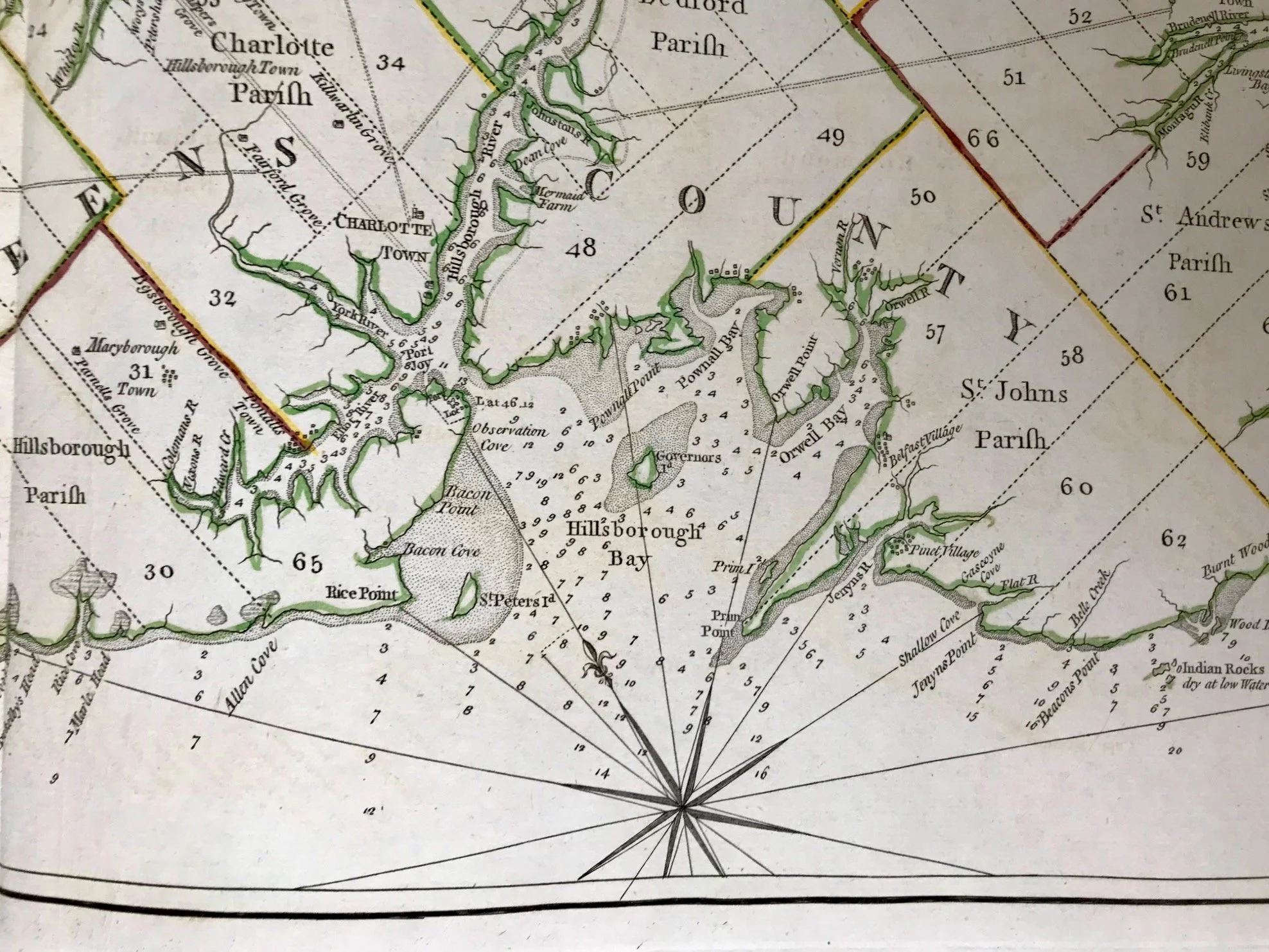
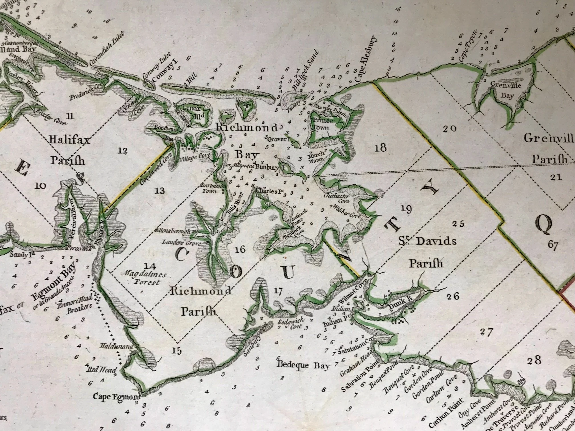
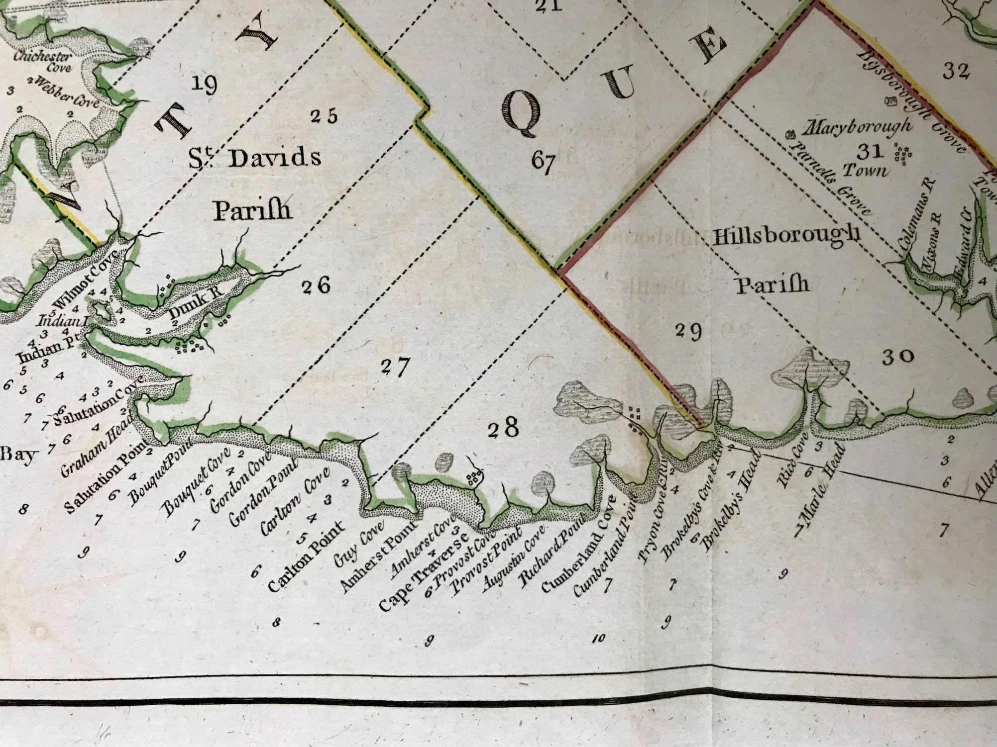
Title: A Map of the Island of St. John In the Gulf of St. Laurence Divided Into Counties & Parishes And the Lots as granted by Government, to which is added The Soundings round the Coast & Harbours Improved from the late Survey of Captain Holland . . . 1775
Cartographer: Thomas Jefferys
Publisher(s): Robert Sayer and John Bennett, London: 1776
Image size: 14 1/2” x 27 1/2” (36.8 x 69.9 cm)
Description: The map was liberated from a copy of Jefferys’ American Atlas. It shows early outline hand-coloring. It also shows a vertical center-fold. Overall, good condition.
In 1763, Prince Edward Island was transferred from French to British sovereignty after the Treaty of Paris. Under British administration, the name of the island was anglicized to St. John’s Island, and Dutch surveyor Samuel Holland was given permission to do a survey of the landmass one year later. By 1765, Holland had created a map that would change the future of the colony permanently. The map came together thanks to the work of four survey parties, named after each lead surveyor; Holland, Haldimand, Wright, and Robinson. The parties were small, including only the lead surveyor, three soldiers, and a seaman from the ship they arrived on. There is evidence that at least three of the four parties included an Acadian guide. Holland’s map would be the first to depict Prince Edward Island in an accurate form. It also indicated more than 200 bays, points, rivers, capes and coves in the land. Yet, perhaps most importantly, it divided the colony into 67 townships or “lots” of 20,000 acres each, and 14 parishes. Many of those lots were granted to British military officers, or others who the government owed favours to.
Source: https://www.peimuseum.ca/collections/maps-of-the-island